


Gallery-quality prints · Independent artists · Décor to adore

” by ArtHistory")

from $ 15
” by ArtHistory")

from $ 15
” by Alleycatshirts")

from $ 11
” by Alleycatshirts")
from $ 11


from $ 15
” by Alleycatshirts")

from $ 11
” by Alleycatshirts")

from $ 11


from $ 11
” by Alleycatshirts")

from $ 11
” by Alleycatshirts")

from $ 11


from $ 11
” by Alleycatshirts")

from $ 11
” by Alleycatshirts")

from $ 11
 Vintage England, Scot” by Alleycatshirts")

from $ 11
 Vintage Great” by Alleycatshirts")

from $ 11
” by Alleycatshirts")

from $ 11
 Vintage Engl” by Alleycatshirts")

from $ 11
” by ArtHistory")

from $ 15
” by ArtHistory")

from $ 15
” by ArtHistory")

from $ 15
” by ArtHistory")

from $ 15
” by ArtHistory")

from $ 15
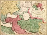
![Carte de Tartarie (1706) [Map of Russia]](http://thumbs.imagekind.com/6502681_650/Carte-de-Tartarie--Map-of-Russia_art.jpg?v=1571421267 "“Carte de Tartarie (1706) [Map of Russia]” by ArtHistory")
![Carte de Tartarie (1706) [Map of Russia]](http://thumbs.imagekind.com/6502681_200/Carte-de-Tartarie--Map-of-Russia_art.jpg?v=1571421267)
from $ 15
” by ArtHistory")

from $ 15
” by ArtHistory")

from $ 15
” by ArtHistory")

from $ 15
” by ArtHistory")

from $ 15
” by ArtHistory")
from $ 15
” by ArtHistory")

from $ 15
” by ArtHistory")

from $ 15